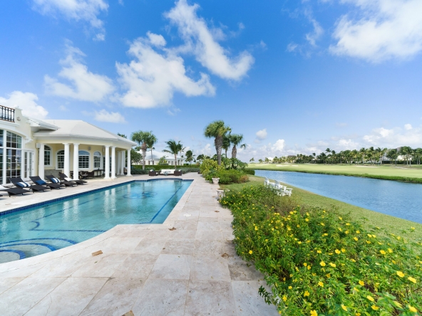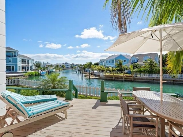
With our airports scheduled to reopen to Domestic commercial flights on the 8th of June and International commercial flights on the 1st of July, this list of airports in The Bahamas will help you find the perfect location for your future vacation and your future home.
Click the airport for nearby real estate exclusively listed with Engel & Völkers Bahamas, or contact our advisors to find your dream home in The Bahamas.
| Location Served | ICAO | IATA | Airport Name | Coordinates |
| ABACO | ||||
| Castaway Cay | MYAG | Castaway Cay Airport (private) | 26°5′26.0″N 77°32′23.9″W | |
| Marsh Harbour | MYAM | MHH | Marsh Harbour Airport | 26°30′41.1″N 77°5′0.7″W |
| Mores Island | MYAO | Mores Island Airport | 26°19′4.5″N 77°33′44.3″W | |
| Sandy Point | MYAS | Sandy Point Airport | 26°0′17.0″N 77°23′43.9″W | |
| Scotland Cay | MYXI | Scotland Cay Airport (private) | 26°38′31.0″N 77°4′2.9″W | |
| Spanish Cay | MYAX | Spanish Cay Airport | 26°57′1.2″N 77°32′37.7″W | |
| Treasure Cay | MYAT | TCB | Treasure Cay Airport | 26°44′43.2″N 77°23′27.6″W |
| Walker Cay | MYAW | WKR | Walker Cay Airport | |
| ACKLINS | ||||
| Spring Point | MYAP | AXP | Spring Point Airport | 22°26′30.8″N 73°58′14.9″W |
| ANDROS | ||||
| Andros Town, North Andros | MYAF | ASD | Andros Town Airport (Fresh Creek Airport) | 24°41′52.7″N 77°47′44.4″W |
| Andros Town | MYCZ | Autec Heliport | 24°42′34.2″N 77°46′21.5″W | |
| Congo Town, South Andros | MYAK | COX / TZN | Congo Town Airport (South Andros Airport) | 24°9′31.5″N 77°35′23.4″W |
| Mangrove Cay | MYAB | MAY | Clarence A. Bain Airport | 24°17′15.6″N 77°41′3.9″W |
| Nicholls Town, North Andros | MYAN | SAQ | San Andros Airport | 25°3′13.8″N 78°2′57.4″W |
| BERRY ISLANDS | ||||
| Big Whale Cay | MYBW | Big Whale Cay Airport | 25°24′7.2″N 77°47′18.3″W | |
| Chub Cay | MYBC | CCZ | Chub Cay International Airport | 25°25′1.8″N 77°52′50.5″W |
| Cistern Cay | MYBT | Cistern Field | 25°46′46.8″N 77°53′8.2″W | |
| Great Harbour Cay | MYBG | GHC | Great Harbour Cay Airport | 25°44′18.2″N 77°50′25.0″W |
| Little Whale Cay | MYBX | Lt. Whale Cay Airport | 25°26′58.5″N 77°45′34.2″W | |
| BIMINI | ||||
| Cat Cay | MYCC | CXY | Cat Cay Airport | 25°33′19.0″N 79°16′33.8″W |
| Ocean Cay | MYBO | Ocean Cay Airport | 25°25′22.5″N 79°12′34.1″W | |
| South Bimini | MYBS | BIM | South Bimini Airport | 25°41′59.9″N 79°15′54.8″W |
| CAT ISLAND | ||||
| Arthur’s Town | MYCA | ATC | Arthur’s Town Airport | 24°37′46.9″N 75°40′27.9″W |
| Cutlass Bay | MYCX | Cutlass Bay Airport | 24°8′56.9″N 75°23′53.0″W | |
| Hawks Nest | MYCH | Hawks Nest Airport | 24°9′15.1″N 75°31′13.0″W | |
| New Bight | MYCB | CAT | New Bight Airport | 24°18′55.1″N 75°27′9.2″W |
| CROOKED ISLAND | ||||
| Colonel Hill | MYCI | CRI | Colonel Hill Airport (Crooked Island Airport) | 22°44′43.4″N 74°10′57.0″W |
| Pitts Town | MYCP | PWN | Pitts Town Airport | 22°49′47.0″N 74°20′47.1″W |
| ELEUTHERA | ||||
| Governor’s Harbour | MYEM | GHB | Governor’s Harbour Airport | 25°17′4.9″N 76°19′51.5″W |
| North Eleuthera | MYEH | ELH | North Eleuthera Airport | 25°28′32.2″N 76°40′52.8″W |
| Rock Sound | MYER | RSD | Rock Sound International Airport | 24°53′42.1″N 76°10′34.6″W |
| EXUMA | ||||
| Black Point | MYEB | Black Point Airport | 24°5′21.4″N 76°23′52.5″W | |
| Farmers Cay | MYE3 | Farmers Cay Airport | 23°57′41.9″N 76°19′34.3″W | |
| Fowl Cay | MYXA | Fowl Cay Airport | 24°16′14.6″N 76°32′27.5″W | |
| Great Exuma Island (George Town) | MYEG | George Town Airport | 23°27′59.6″N 75°46′54.2″W | |
| Great Exuma Island (Moss Town) | MYEF | GGT | Exuma International Airport | 23°33′45.0″N 75°52′39.2″W |
| Hog Cay | MYEY | Hog Cay Airport | 23°23′50.7″N 75°29′49.5″W | |
| Leaf Cay | MYXD | Leaf Cay Airport | 24°8′57.9″N 76°28′22.5″W | |
| Lee Stocking | MYXE/MYEL | Lee Stocking Airport | 23°46′32.1″N 76°6′13.4″W | |
| Little Darby Island | MYXF | Little Darby Island Airport (private) | 23°51′28.5″N 76°13′22.5″W | |
| Norman’s Cay | MYEN | NMC | Norman’s Cay Airport | 24°35′39.5″N 76°49′12.3″W |
| Rudder Cut Cay | MYX7 | Rudder Cut Cay Airport | 23°53′11.1″N 76°15′10.2″W | |
| Sampson Cay | MYXH | Sampson Cay Airport (private) | 24°12′58.6″N 76°28′42.9″W | |
| Staniel Cay | MYES | TYM | Staniel Cay Airport | 24°10′10.8″N 76°26′21.4″W |
| GRAND BAHAMA | ||||
| Deep Water Cay | MYGD | Deep Water Cay Airport | 26°37′57.1″N 77°55′19.1″W | |
| Freeport | MYGF | FPO | Grand Bahama International Airport (Freeport Int’l) | 26°33′31.6″N 78°41′43.6″W |
| Grand Bahama | MYGW | WTD | West End Airport (reopened) | 26°41′12.4″N 78°58′44.3″W |
| Grand Bahama | MYGM | GBI | Grand Bahama Aux AF Airport | 26°37′54.6″N 78°21′35.4″W |
| INAGUA | ||||
| Matthew Town | MYIG | IGA | Inagua Airport (Matthew Town Airport) | 20°58′29.9″N 73°40′0.9″W |
| LONG ISLAND | ||||
| Cape Santa Maria | MYLM | Cape Santa Maria Airport | 23°38′56.0″N 75°19′24.0″W | |
| Deadman’s Cay | MYLD | LGI | Deadman’s Cay Airport | 23°10′43.4″N 75°5′37.2″W |
| Hog Cay | MYXC | Hog Cay Airport | 23°36′4.1″N 75°20′20.8″W | |
| Long Island | MYLR | Hard Bargain Airport | 23°0′40.3″N 74°54′21.2″W | |
| MAYAGUANA | ||||
| Mayaguana | MYMM | MYG | Mayaguana Airport | 22°22′50.0″N 73°0′40.1″W |
| NEW PROVIDENCE | ||||
| Nassau | MYNN | NAS | Lynden Pindling International Airport | 25°2′9.8″N 77°28′8.4″W |
| RAGGED ISLAND | ||||
| Duncan Town | MYRD | DCT | Duncan Town Airport | 22°10′54.7″N 75°43′45.6″W |
| RUM CAY | ||||
| Port Nelson | MYRP | RCY | Port Nelson Airport | 23°41′0.4″N 74°50′10.5″W |
| SAN SALVADOR | ||||
| Cockburn Town | MYSM | ZSA | San Salvador Airport (Cockburn Town Airport) | 24°3′47.3″N 74°31′25.0″W |